Table of Contents
3. Ergonomics
In this chapter the general way to use the geoportal's functions is described.
3.1 Page structure
All the pages are composed of:
- A header : the horizontal stripe and one or more lines with general functions
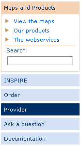
- A menu on the left side : the specific functions of the geoportal
- A principal part : Static and dynamic information in connection with the actual function
- A footer
3.2 Navigation principles
The navigation principles are the same on every site page.
On the 1st and 2nd level, the navigation is organized in the vertical navigation bar on the left side, with mouse-over effect and highlighting of the active link by means of color change from blue to orange.
From the 3rd level downwards, navigation is incorporated in the page contents.
 Every page has an arrow button on the upper right, which leads to the superior level.
3.3 Presentation of the content pages
The pages generally display a frame with a title composed of:
- the function of the superior level
- the actual function
On the 1st navigation level, the pages contain a brief presentation of all the 2nd level functions.
On the 2nd navigation level, the pages contain the specific information for the actual function.
3.4 Footer
Top of the page
By clicking on the link mentioned above, the user can go back to the top of the page.
Other information and copyright
At the bottom of every page, on the right, the following information is displayed:
- © Editor
- Legal aspects concerning the use of the website
- Contacts
3.5 Languages
The geoportal is multilingual : Luxembourgish, French, German and English are supported. To change the language, click on the corresponding button on the upper left of the page:
3.6 Paginated lists
All the lists with search results are paginated and contain the information split into different pages. The properties of the list contents are displayed:
- Total number of items in the list
- Links to the different list pages, where the actual page is displayed in bold characters
- Arrows to open the page before, or the next page
- A button to display the complete list without pagination
3.7 Sort
All the lists can be sorted by any of its columns, either in ascending or descending way.
After being sorted, the list is reinitialized and the first list page is displayed.
3.8 Tags
To clearly present the contents, tags are frequently used.
Every tag header reacts to clicking. When a new tag is opened, the fields in the actual tag are automatically validated before switching to the new tag.
3.9 Actions

The different actions that can be done at a certain stage are represented by hypertext links, whose clickable text explains the action.
The different options are simply separated by the character .
Except for the very specific actions, the current actions will generally use the following terms:
- Create : to create a new entity
- Modify : to modify an existing entity
- Validate : to validate and store encoded values
- Cancel : to disregard the newly encoded values and restore the original values in the fields
- Back : to go back to the element before or to the upper level
The text is completed by an indication of the entity on which the function operates. For example “Back to the order list”.
3.10 Colours
A simple colour code is used in the interface, to specify the current state:
- Blue : validated and inactive part
- Orange : activated part currently undergoing modification
Note : For tags without any content, the text remains blue and italic, and will not be reactive to clicking.
3.11 Procedures with multiple steps
For complicated procedures with an important number of intermediary actions, the user is guided through different steps like shown in the example.
The steps already passed and validated are indicated in normal font, the current step in bold font, and the next steps in italic font.
At every moment, the user can go back one ore more steps by simply clicking on the link of the corresponding step.
3.12 Warning messages
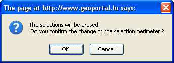
The geoportal exchanges information with its user. This can be data or information concerning the user's actions.
3.12.1 Information message
When an action of the user does not give any visible result on the screen, the system shows a message to indicate that the action has been done with success. For examble, after sending an order, the system shows the following confirmation message:
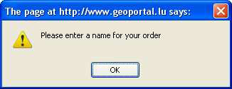
3.12.2 Error message
In case of an error, when entering data, the system alerts the user that some rules have not been respected and specifies the problem that has to be corrected.


