Lëtzebuergesch (lu)
Français (fr)
Deutsch (de)
English (en)
Portals
Lëtzebuergesch (lu)
Français (fr)
Deutsch (de)
English (en)
Portals
Description: Middle parts of road lines are not assigned to the road name. 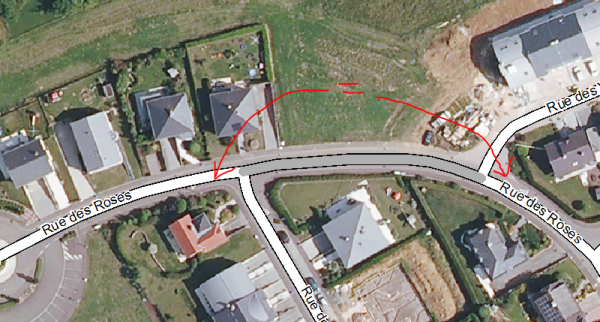 Solution : The script that was eliminating single nameless parts embedded by two parts with the same name was extended to merge all unnamed part of a road that are neighbors to one.
Description: Parts of known roads are misassigned, mainly at crossings. At the crossing of road A and B the first part of road B is misassigned as part of road A.
 Solution : A script was developed that is checking if more than one name occurs between two crossing. These features are marked as “à verifier”
Description: Road features are not conform to the underlaying orthophoto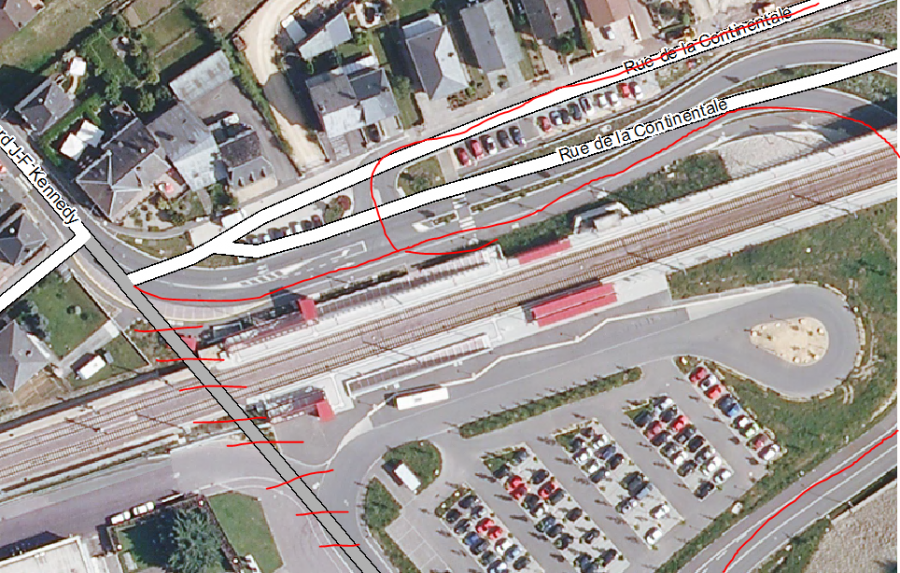
Solution : None.
Descrition: Orthophoto is not up-to-date, there are parcels with no visible roads.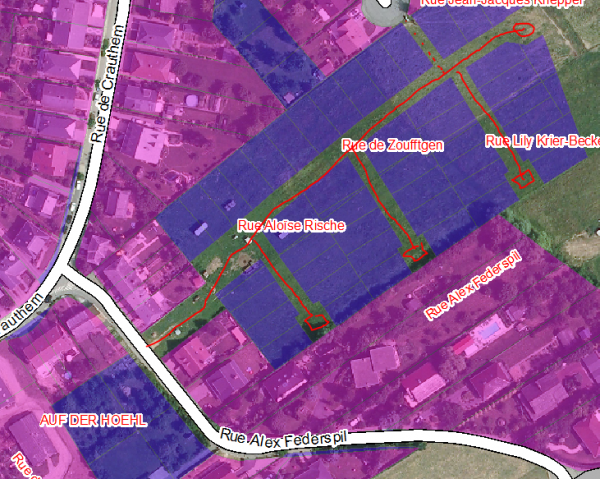
Description: Small road fragments (less 15-20 m) weren't assigned to any address. The names between crossing script detect those cases.
Improvement propose: All small fragments less then 20 m (minimal size of a single road?) should copy the name of the neighbor if they are between the same pair of crossing.


Solution: (27.11.2013) A script was developed that is using the between crossing segments and checks if there is one known and one unknown part, if the unknown part is shorter then 20 m, the name of the known part was set as name of the short part.
Comment: Road names are unique for each locality.
POS IMPROVEMENT: For each line check if there are any touching lines with the edge elements. From that selection check if there are 2 lines with identical names → high chances that the unknown part could be part of that line. Attention: It's necessary to check if the neighbors with the same are not touching the same edge of the candidate line.
COMMENT: Rue generally ends at crossings. POS IMPROVEMENT: Check if end of road is located at the intersection of other roads
